Deviation Actions


Description
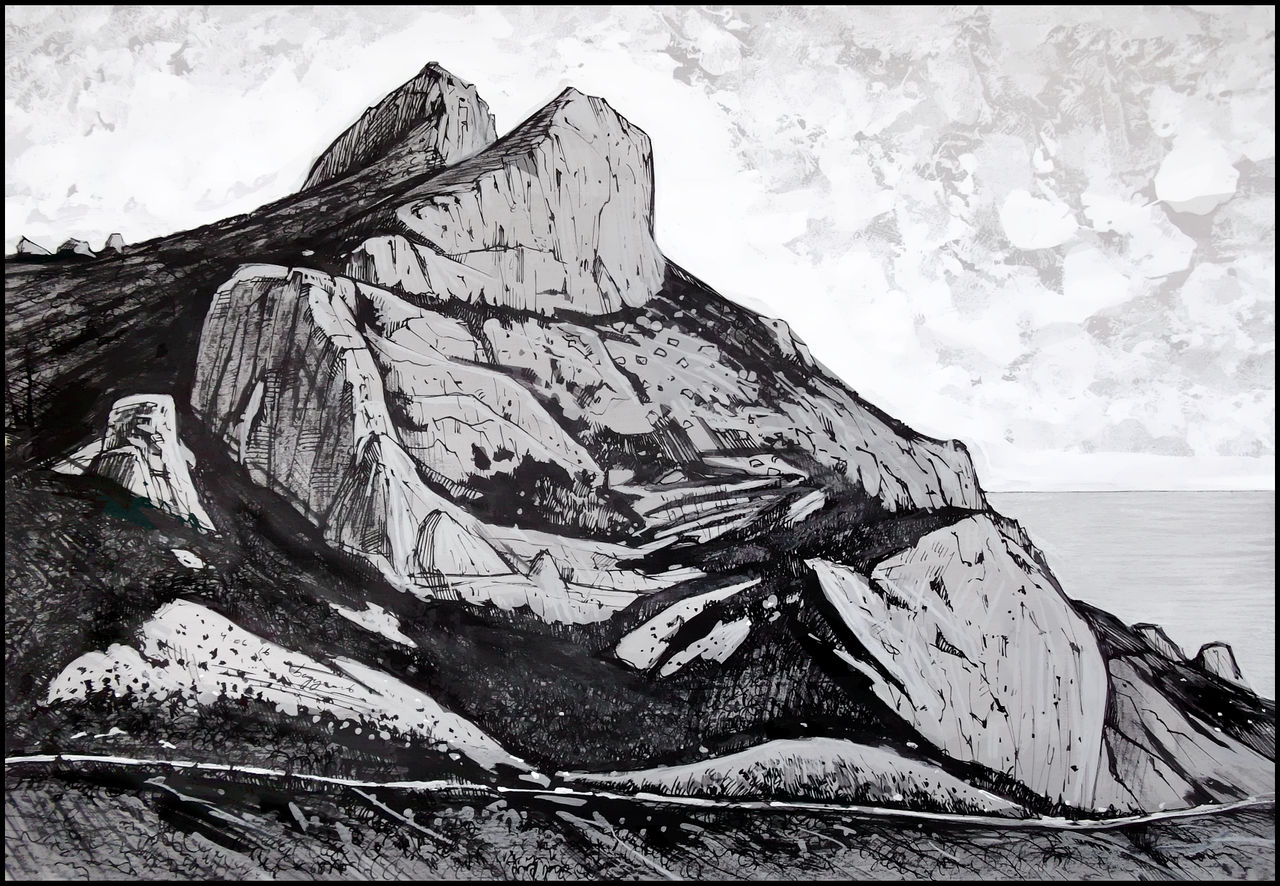
Ильяс-Кая («скала Ильи») возвышается над трассой, идущей от Ласпинского перевала к Ялте. Массив состоит из нескольких скальных вершин: 1) собственно, сама Ильяс-Кая (681 м); 2) хребет Деликли-Бурун (он же «Дырявый мыс» или «Лягушка»); 3) скала Палец Деликли-Бурун. На седловине между Байдарской яйлой и Ильяс-Кая стоят несколько скальных останцев — скалы Тышлар (в народе — «Храм солнца»). В 1966 году советские археологи обнаружили на Ильяс-Кая остатки укреплённого крымско-греческого монастыря X–XIII вв. и церкви Св. Ильи.
Ilyas-Kaya («Elias Rock») towers above the highway between the Laspi Pass and the city of Yalta (Crimea, Russia). The mountain massif consists of several peaks: 1) the Ilyas-Kaya itself (681 m); the rocky crest Delikli-Burun (a.k.a. “Holey Cape” or “Frog”); 3) the Delikli-Burun-Finger rock. Besides, there are several outliers (separate rocks) called Tyshlar (a.k.a. “the Temple of the Sun”) in the col between the Baydar Yayla massif and Ilyas-Kaya mountain. In 1966, Soviet archeologists found the remnants of a fortified X–XIII-century Crimean Greek monastery and of a church dedicated to St. Elias on the mountaintop.
Date: June 4, 2016.
Materials: black ink (dip-pen & brush) and white acrylic paint on gray paper, 41x59 cm.
Материалы: чёрная тушь (кисть/перо) и акриловые белила на серой бумаге, 41x59 см.
This place on Yandex maps: goo.gl/n70x22
360° panorama of this place: www.krym.info/foto/img700.htm